Urban Waterlogging Mitigation Forum
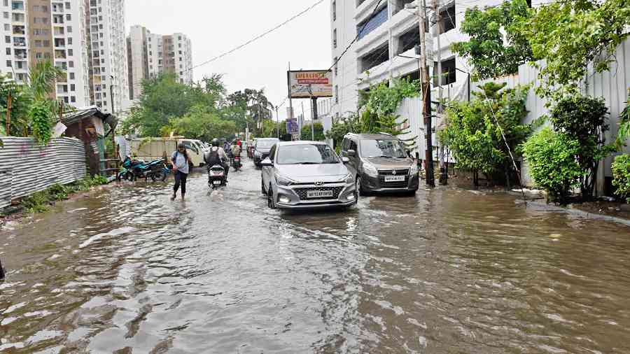
Increasing GHG emissions are accelerating changes in weather patterns, causing erratic and more frequent rainfall. This affects almost all cities in India. Waterlogging, loss of life, and infrastructure damage have become a recurring problem. This situation is expected to worsen further in the future.
How do we address this challenge and solve the problem?
Fortunately, there are scientists and start-ups across the country who can address various aspects of this growing challenge. However, they need to work together to take up the challenging task of eliminating waterlogging. Not much can be done about erratic rainfall, but certainly ensure that streets are not filled with water.
Our Goal:
ITEL, through its Urban Waterlogging Mitigation Forum has brought together scientists, start-ups, and industry players from across the country and has formed a consortium to address the problem. The goal is to develop and implement a solution in various towns and cities to eliminate waterlogging through a systematic approach.
How do we do this?
To attain this goal, the forum has devised a structured and comprehensive approach to address various aspects of this challenge.
Choose the site and connect with the authorities
As the first step, the forum will identify a suitable township or zone in the city to kick-start the waterlogging mitigation process. The team engages with the city authorities to discuss and finalise the details, and procures the necessary permissions to begin work.
Detailed mapping of the valleys and the slopes
The team maps the zone or the township using data obtained from high-resolution satellite and drone images to identify natural valleys. This in-depth mapping ensures the area is mapped accurately up to 1 meter resolution. These valleys are the areas where rainwater will naturally accumulate if not evacuated.
Get a detailed drain map with capacity details
Obtain and digitize the full drain map, including the location, size, and capacity of the drains. This will help create a baseline for assessing the quantity of water that can be evacuated at any given time, and mainly during peak rainfall.
Simulation of water collected and evacuation to create a water flow and draining model
Build a simulator that will take the data from previous two steps, and compute how much water gets evacuated every minute from each valley. This will help calculate the excess water that cannot be drained off in real-time, leading to waterlogging. Also, estimate the extent of groundwater absorption in the area and build it in the simulator.
Detect and remove blockages
Build, develop, and deploy technology to measure the extent of blockages in all drains. Build robotic systems that can enter drains and clean up the blockages. Once the drains are clean, the actual drainage must match the simulation results described in the earlier step, whenever rainfall happens. If that is not the case, something is still missing - perhaps the drain is still blocked or, the groundwater absorption estimate is inaccurate. Carry out required corrections accordingly.
Assess the existing groundwater absorption system
Study the current groundwater absorption structures and natural points in the chosen area. Identify faulty and broken structures that need repair, and rectify them to maximize their effectiveness. Also, identify additional ground-water absorption structures that can be added.
Collate recent rainfall and waterlogging data
Collate the rainfall and waterlogging data from the last few years, and determine from simulations the extent of drain blockages that have led to waterlogging, with the help of advanced technologies such as IoT and sensors. Comparing these measurements with simulation results obtained earlier will indicate blockages in the drains
Collating historical heavy and abnormal rainfall data for the past 50 years
Collate data and identify the worst-case rainfall events from the past 50 years. Simulate scenarios of varied rainfall intensities ranging from 30 to 50 percent hike and assess rainfall peak durations for two, six, and twenty-four hours, and up to three days. Figure out whether all water can be evacuated, assuming there is no blockage in the drains
Enhance water absorption capacity
Plan and build improved water absorption structures to supplement the existing man-made and natural absorption systems. Estimate how much additional capacity can be absorbed, and confirm these estimates with simulations.
Plan and build additional drains
If both simulations and real-world data show that water during peak rainfall cannot be drained, even after restoring drains and groundwater absorption systems, then additional measures such as the creation of new drains and/or absorption points must be constructed. The simulator will provide prior estimates of water-drainage during heavy rainfall for each additional drain. This will help plan the location and capacity of new drains
Post implementation, both rainfall and waterlogging require continuous monitoring to ensure complete waterlogging mitigation.